1368 · From beggar to emperor
East Asia · South China
The Ming founder, Zhu Yuanzhang, began life as an orphaned peasant and a wandering Buddhist monk.
300,000 years of human history, region by region. Eleven columns, one for each part of the world, run from the first Homo sapiens at the top to today at the bottom, so you can see what was happening everywhere at the same time.
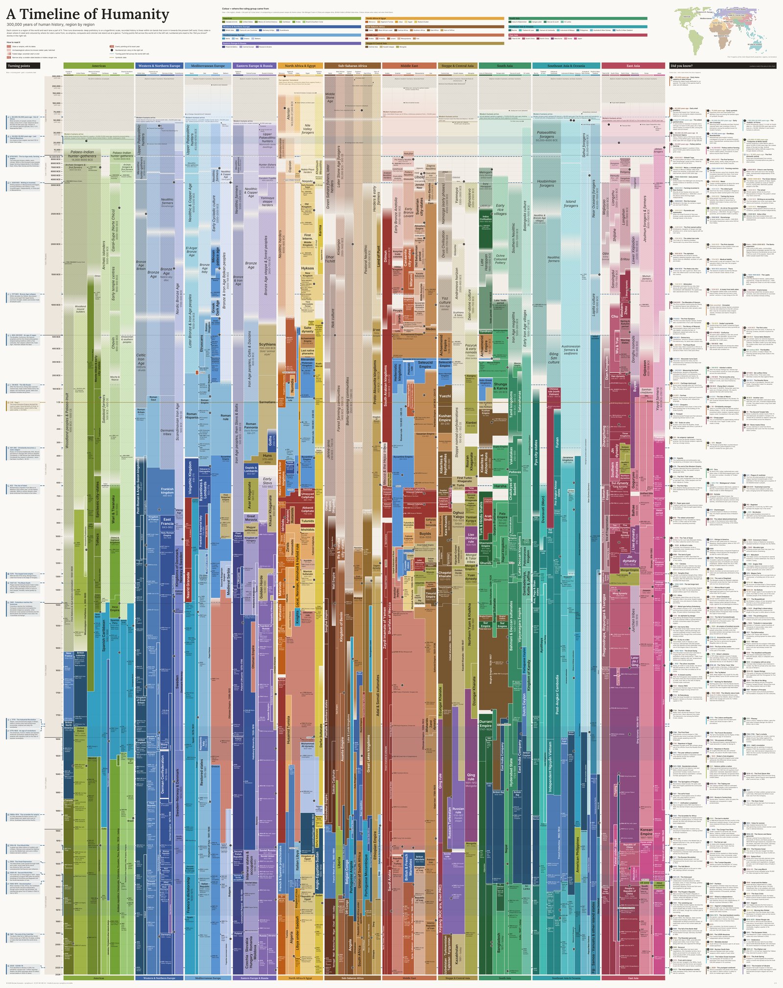
Scroll or pinch to zoom, drag to move around. Use the full-screen button for the best view.
These were written for the poster, but the story rail was full. They went through the same checks as the cards on the poster.
The Ming founder, Zhu Yuanzhang, began life as an orphaned peasant and a wandering Buddhist monk.
Vasco da Gama sailed from Lisbon around Africa to Calicut, opening Portugal's Asian trade empire.
Vijayanagara's capital was among the world's largest cities around 1500. It was sacked in 1565.
Babur founds the Mughal Empire at Panipat; the same year, the Ottomans crush Hungary at Mohács.
From Yemen's port of Mocha, coffee houses spread through the Ottoman Empire, then to Europe.
The poster is designed to be printed full size. Take the PDF to any print shop with a large-format printer and ask for:
A 44-inch roll leaves almost no margin. If the shop's printer needs wider edges, they can print on a wider roll and trim it.
Printing it smaller works, but below about A0 the smallest text becomes hard to read.
You are free to download, print, share and display this poster for non-commercial purposes, including in classrooms, as long as you credit “Nicolas Goossens, synoptica.ch” and do not modify it.
You may pay a print shop to print a copy for your own non-commercial use.
For translations, adaptations or commercial use, please write to hello@synoptica.ch.
Licence: Creative Commons BY-NC-ND 4.0.
I designed and edited the poster. The first draft of the data was written with an AI assistant; every regional column was then checked item by item against published sources, chiefly the Encyclopaedia Britannica, the Cambridge histories and the UNESCO General History of Africa, with a second check on the most debated topics. Corrections were reviewed and applied by hand.
This is careful work, but it is not peer review by specialist historians. Full sources and credits.
Corrections are very welcome and will go into the next version, with thanks if you wish.
Or write to hello@synoptica.ch with the column, the date or pin number, and a source if you have one.
One short email when the corrected version or a new poster is out. No other use of your address; unsubscribe at any time.
Sign up by email